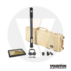
Description
OKM GeoSeeker
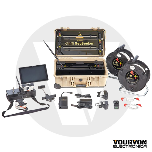
Water detector and cavity detector GeoSeeker
Are you looking for underground water resources or hidden cavities up to depths of 250 meters (820 feet)?
The GeoSeeker is a professional geoelectrical water detector and cavity detector that measures the ground resistivity and visualizes its scan data in incredible 3d graphics. It is a very mobile and easy to operate geoelectrical detector designed and manufactured in Germany.
The GeoSeeker’s hardware components are completely controlled by a modern Android Tablet PC. All commands and measurement results are transferred wireless via Wi-Fi. Using the pre-installed software application you simply select one of three supported scan modes:
- Active Scan (Accurate)
While using this scan mode the GeoSeeker utilizes two electrodes to inject electrical power into the underground soil. Two additional electrodes are measuring the potential difference (fall of voltage) at specific scan points to calculate the final resistivity value. This mode is used to detect underground water deposits, hidden caves or even impervious layers and barriers within the underground soil. In active scans you will be able to define a specific depth range in that you are going to conduct your measurement. So you will define a starting and ending depth between 5 meters (16 feet) and 250 meters (820 feet). - Active Scan (Quick)
This scan mode is a quick version of the accurate scan. It is also injecting electrical current into the underground and measuring the potential difference (fall of voltage) to calculate the resistance of the soil. - Passive Scan
While using this scan mode the GeoSeeker only utilizes two electrodes to read the natural occurring voltage of the underground (no electrical power is injected into the underground). This mode is used to detect underground flowing water only.
The graphical user interface of the water detector GeoSeeker is available in the following languages:
- Deutsch
- English
- Français
- Español
- Italiano
- عربي
- Ελληνικά
- Türkçe
- 中文
- Pусский
- Nederlands
- فارسی
The GeoSeeker’s software application is providing simple step-by-step instructions to assist you in completing the measurement. You simply follow these pictured instructions until your measurement has been finished. After completing the measurement a graphical 3d representation of the measure values is created and displayed on the screen of your Tablet PC. Some color adjustment options are provided to optimize the graphical 3d visualization of your underground water deposits, water-bearing gravel and groundwater level (shown in bluish colors) as well as cavities, caves, tunnels, chambers or impervious layers (shown in reddish colors).
The GeoSeeker’s hardware is built-in into a waterproof and shock-resistance Peli case. So your geoelectrical equipment is well packed and always ready for transportation.
